
Springfield Neighbors by Source
A block lookup works best when each official source keeps its proper role. Sangamon County GIS shows parcel shapes and nearby land. The tax portal supplies an owner field and parcel details. The Recorder indexes parties to documents. Springfield's city systems add neighborhood boundaries, permits, and public service requests. None is a public household census, and none proves that an owner or mailing contact is one of the current Springfield neighbors at the site.
| Source | Block evidence | Access route |
|---|---|---|
| Sangamon County GIS | Parcel geometry, roads, adjacent lots, map context, and reports | Free interactive viewer |
| Property Tax Search | Owner field, parcel number, address, class, tax code, and legal description | Free county portal |
| Recorder land records | Deeds and other instruments for one parcel at a time | Online routes, public terminal, and older microfilm |
| Voter records | Self-registration match or regulated list products, not public block browsing | State self-lookup or permitted county request |
| Neighborhood organizations | Registered service polygons and public group contacts, not member households | City OPED list and ArcGIS layer |
| Historical street sections | Past names and addresses near a Springfield block | Lincoln Library local-history collection |
Use the GIS map to define which parcels count as nearby, then open each property record separately. An alley, rear lot line, road, easement, or water feature may make visual closeness misleading. For a full named street rather than the immediate block, the Springfield street directory owns the longer address-by-address workflow.
Map Springfield Neighbors Parcel First
The Sangamon County GIS viewer is the main adjacent-parcel tool. Its visible controls include Search Parcel, Locate, Layers, map click, Create Property Report, Create Property Map, Print Map, measurements, and report downloads. The live layer names were not exposed during static research, so work from the controls actually present rather than assuming a special neighbor or buffer button.
- Locate the starting Springfield address or parcel and confirm its shape against the street and cross streets.
- Click each parcel that touches the front, side, or rear boundary. Record the parcel number before opening another lot.
- Run that number in the county tax portal. Save the situs line, mailing field, owner, class, tax code, legal description, and assessment date separately.
- Repeat for every lot in the chosen radius. Do not turn map labels into a list of people who live there.
- Use the Recorder only when a deed chain or recorded instrument is needed for one of those parcels.
This process produces a land-and-owner view of the Springfield block. It does not reveal all household members, and the mailing address may differ from the property address. Parcel geometry is also a map aid rather than a legal survey.
Check Springfield Parcel Fields
The Sangamon County Property Tax Search accepts parcel number, owner name, house number, direction, street name, and city. A complete parcel or owner name bypasses other search fields. Without one, the portal asks for at least five parcel digits, a house number, or a street name. More than 300 matches must be refined. This makes the portal useful after GIS supplies an exact parcel number.
| Field | How it helps a block search |
|---|---|
| Parcel Number | Stable key for one selected lot; usually 11 digits. |
| House Number and Direction | Separates similar street lines and cardinal prefixes. |
| Street Name | Supports partial address work; a single-digit numbered street may need a leading zero. |
| City | Choose Springfield while remembering that mailing geography and city limits can differ. |
| Owner Name | Recorded tax contact, not proof of current occupancy. |
Result actions can lead to Parcel Summary, Current Assessment, billing history, sales details, tax sales, and owner or legal-description history. Those fields add context to Springfield neighbors research, but they should stay tied to the record date.
Springfield Neighborhood Organization Layer
The Springfield Office of Planning and Economic Development publishes a neighborhood and homeowners association inventory. Captured names include Enos Park Neighborhood Improvement, Historic West Side, Iles Park, Harvard Park, Lincoln Park, MacArthur Boulevard, Old South Town, Pillsbury Mills, Springfield Lake Shore Improvement, Vinegar Hill, and Westend Neighborhood Watch. The city also invites groups to add or update an association listing.
The official organization page is shown below.
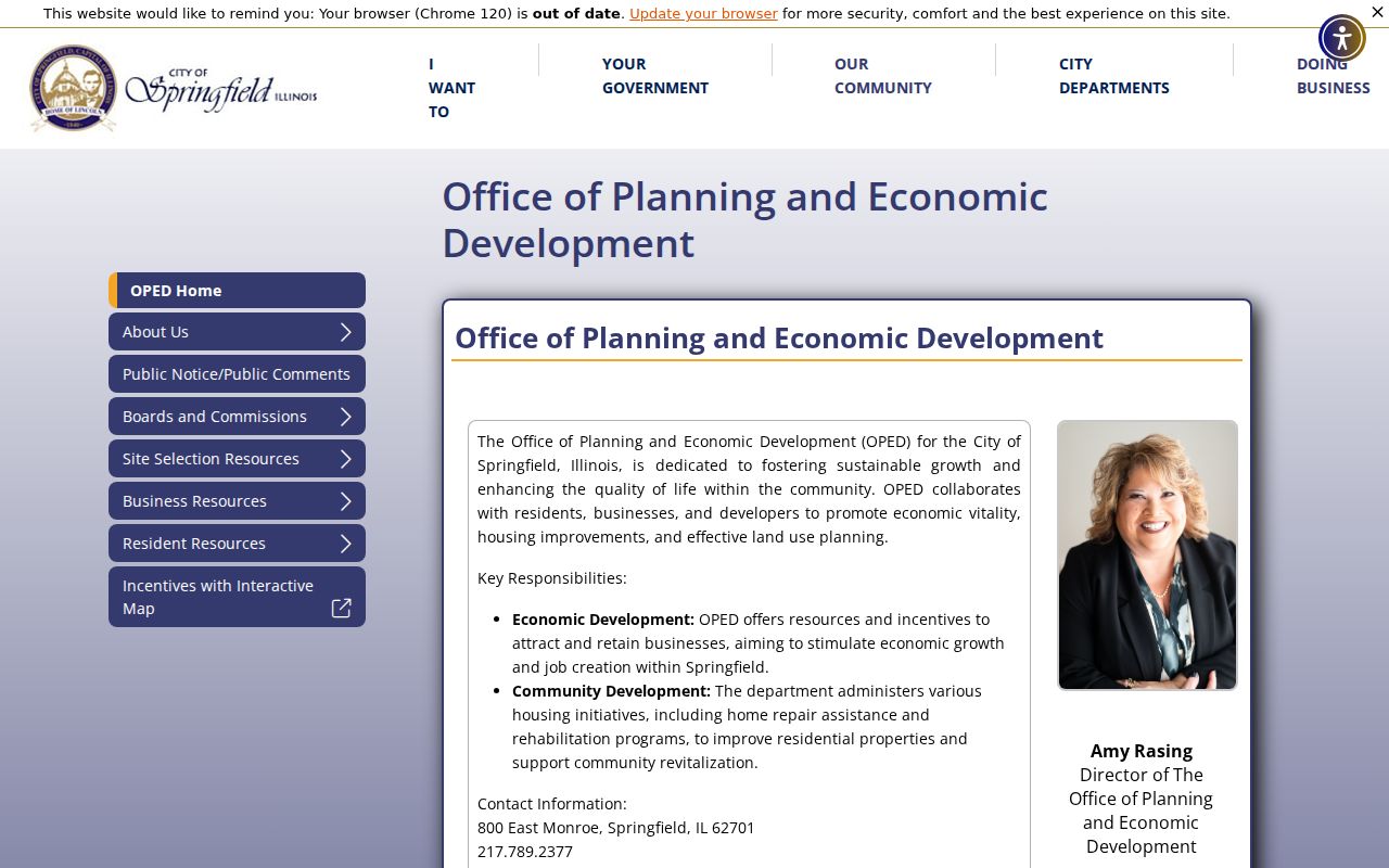
Use the inventory to identify a public group that may serve a block. It does not prove membership, publish every household, or show that each Springfield address is inside an active organization.
City OPED
Official inventory and association update route for Springfield groups.
SSCRPC
The regional planning commission encourages neighborhood groups to register.
Springfield ICON
An established nonprofit source for association map and organizing guidance.
Map Springfield Association Coverage
The city's Neighborhood Organizations ArcGIS layer is a polygon file for registered organizations. The service description says those organizations cover about half of Springfield's land area and have elected officers and bylaws. It supports query, GeoJSON, and PBF, with a maximum record setting of 2,000.
The official service layer exposes the data source behind the community map.
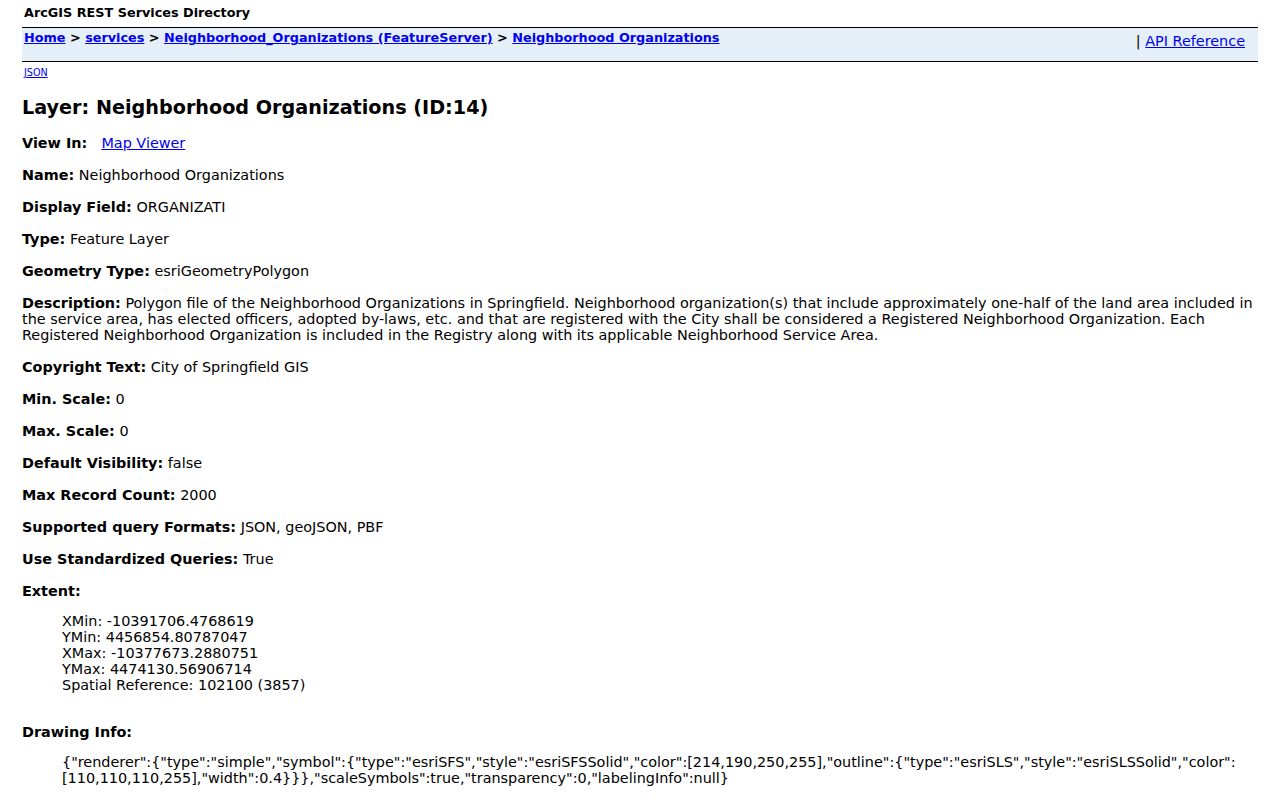
A polygon can show that an address falls within a registered group's area. It cannot show that your neighbors joined, that the roster is public, or that every group boundary matches a ZIP, ward, subdivision, or parcel line.
Note: Springfield's association, ZIP, ward, and parcel maps answer different questions and should never be treated as interchangeable boundaries.
Springfield Blocks Are Not Voter Lists
The Illinois online voter lookup is a private match tool for a person checking registration. It requires first and last name, birth date, five-digit ZIP, street number, and a street name that loads after the ZIP. It has no public command to display all Springfield neighbors on a block. Do not enter another person's identifying data merely to test an address.
Sangamon County can prepare voter lists in address or street walking order, by precinct, ward, district, or household. That does not turn the roll into a general directory. Requests use a signed form, fee callback, and sworn limits for bona fide political or governmental use. Illinois election law bars commercial solicitation and business use. State public-screen access also carries timing, copying, redaction, and purpose controls. Ask the County Clerk elections staff for the permitted route rather than trying to use FOIA to bypass those rules.
Springfield Service Requests by Address
The city's service request map accepts a location or address, asks the user to confirm the location and category, allows images, and then collects request details. It concerns public infrastructure and code issues. It is not a directory of Springfield neighbors, and some complaint details may be withheld or limited.
The captured interface shows the address-centered civic channel.
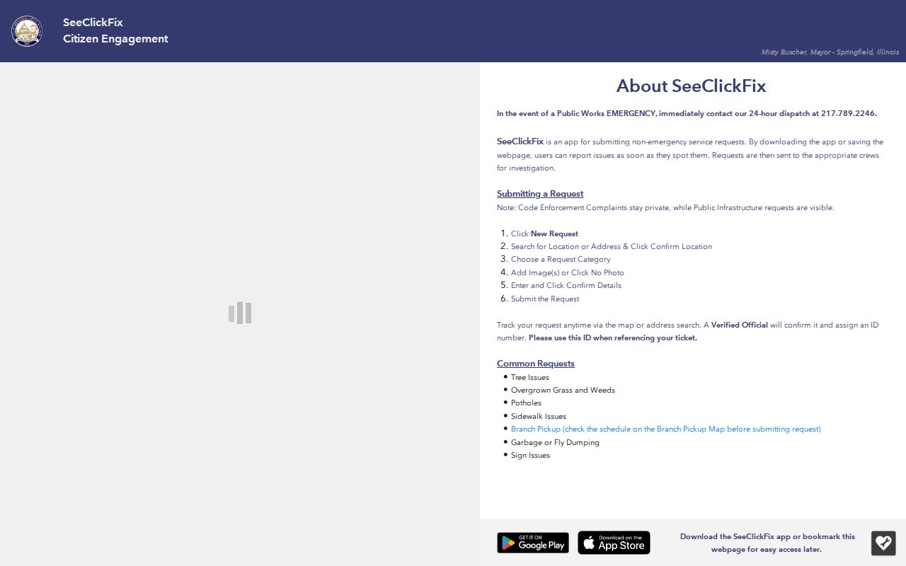
Use a service record to understand a dated city issue at the block, not to infer who filed it or who occupied the surrounding homes.
Historic Springfield Block Records
For an earlier view of the same block, Lincoln Library's Sangamon Valley Collection keeps city and county directories, maps, newspapers, photographs, yearbooks, government files, and planning records. A directory street section can place a name at an address in one printed year. The 1857–58 volume uses initials, cross streets, street-side abbreviations, and an h for residence. A later Jeffersons street section uses a star as an owner mark. Those marks need the volume's own key before they are compared with a current parcel map.
Sanborn editions from 1890, 1906, and 1917 add building footprints and street context, not names. The library obituary cards, which begin in 1861, supply a death date and newspaper date for a known person. Pair the directory entry with the closest released census, then check a deed or newspaper. This reconstructs a dated Springfield block without turning old evidence into a claim about the people there now.
Official Springfield Records Compared
Commercial neighbor tools may merge addresses, phone data, and old names without showing the record date or custodian. Official Springfield and Sangamon County sources are narrower, but their limits are visible. That makes them easier to check and correct.
| Source type | Strength | Main limit |
|---|---|---|
| County GIS and tax records | Dated parcel and owner context from the responsible office | Not a full occupant list |
| City association layer | Official registered group geography | No proof of membership or household identity |
| Historical directories | Address and name clues tied to a printed year | Old, incomplete, and affected by abbreviations |
| Commercial category | Broad lead gathering | Unknown sourcing, stale merges, cost, and opt-out burden |
Use the least intrusive record that answers the question. Save the date and URL, and verify a critical claim with the office that keeps the record.
Protect Springfield Neighbors' Privacy
Public parcel systems do not expose utility accounts, delivery records, or a complete list of renters and household members. Illinois's Address Confidentiality Program gives qualifying victims a substitute address for new state and local agency records, and its special voter process keeps participant information from ordinary public voter lists. The program cannot erase old records and warns that property-record confidentiality cannot currently be assured.
Those gaps are safeguards, not errors to defeat. A Springfield mailing address may be stale, an association polygon may not reflect participation, and an owner may live elsewhere. Describe only what the dated record shows. If personal safety is at issue, use the Attorney General's official confidentiality channel and avoid republishing location details.
Lawful use. Research Springfield neighbors for civic, historical, or personal awareness. Never use public records to track, intimidate, threaten, or harass anyone.